


The National Oceanic and Atmospheric Administration (NOAA) has issued an official El Niño Watch, predicting a 62% probability that the climate pattern will emerge between June and August 2026. This transition follows a weakening La Niña phase and a brief period of ENSO-neutral conditions expected through the spring. While official federal forecasts remain cautious regarding the event’s ultimate intensity, independent meteorologists and historical data models suggest the possibility of a “very strong” or “Godzilla” El Niño, similar to the record-breaking events of 1997-1998 and 2015-2016. Such a development would drastically alter global weather, potentially suppressing Atlantic hurricanes while fueling massive Pacific swells and extreme precipitation across the Southern United States.
FAIR OAKS RANCH, Texas — Federal climate scientists confirmed Wednesday that the global weather pendulum is swinging back toward a warming phase, as the National Oceanic and Atmospheric Administration (NOAA) projected a definitive end to the recent La Niña cycle. The agency’s Climate Prediction Center (CPC) now estimates a 62% chance of El Niño conditions forming by the summer of 2026, a shift that could have profound implications for global agriculture, disaster preparedness, and coastal communities.
The transition is expected to be preceded by a short window of “ENSO-neutral” conditions—where neither a warm nor cold phase dominates—favored with a 55% probability through May and July. However, the rapid accumulation of subsurface heat in the equatorial Pacific has led some experts to warn that the incoming cycle may not be a standard warming event, but rather a “Super El Niño.”
The Mechanics of a ‘Godzilla’ Event
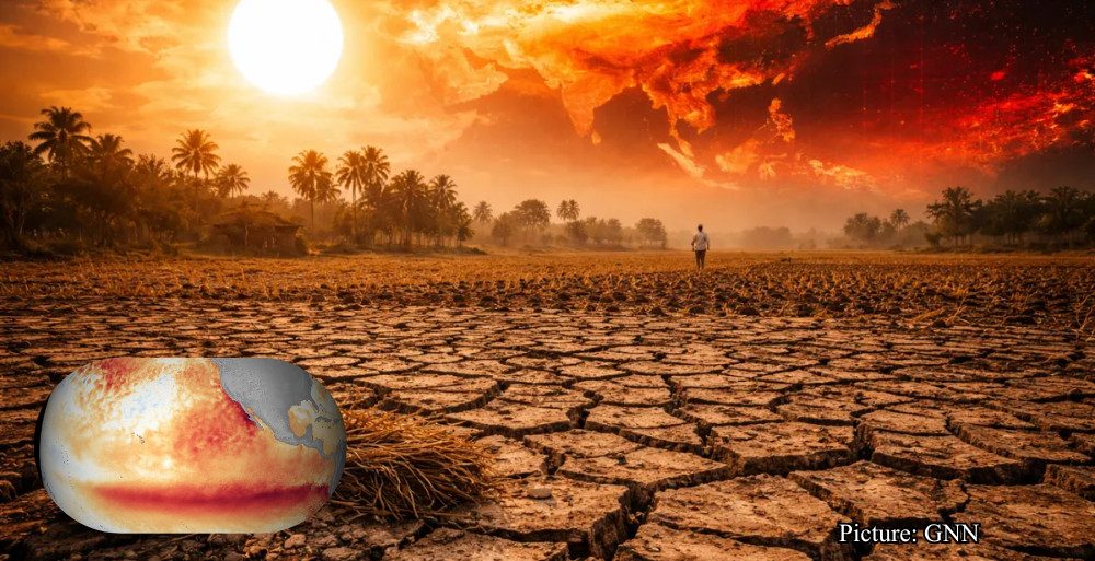
An El Niño occurs when the traditional trade winds that blow from east to west along the equator weaken or reverse. This allows a massive “warm pool” of water to migrate from the western Pacific toward the Americas. When this warming is extreme—typically defined by sea surface temperature (SST) anomalies exceeding +2.0°C in the Niño-3.4 region—it is colloquially labeled a “Godzilla” or “Super” El Niño.
“We are seeing a significant amount of heat stored in the deeper ocean being ‘unearthed’ and moving toward the surface,” noted one NOAA scientist during a technical briefing, describing the atmosphere as “primed” for a shift.
Historically, these monster events have reshaped the planet’s thermal profile. The 1997-1998 El Niño, for instance, was blamed for an estimated $5.7 trillion in global income losses and thousands of deaths due to extreme weather. More recently, the 2015-2016 event saw SST anomalies hit a staggering +3.5°C, leading to the most energetic wave season ever recorded on the U.S. West Coast, with beach erosion levels reaching up to 10 feet in some California precincts.
Regional Impacts: Surfers and Sovereigns
For the surfing community and coastal industries, the “Godzilla” forecast is a double-edged sword. While it promises historically large swells for the Pacific, it also brings the threat of infrastructure damage and coastal flooding.
- The West Coast: Experts anticipate more frequent hurricane-driven swells in the summer, followed by a winter of high-interval, powerful North Pacific swells. However, this is often accompanied by “south-wind” storms that can ruin local conditions and cause severe flash flooding.
- The East Coast: El Niño typically increases vertical wind shear over the Atlantic, which “tears apart” developing tropical storms. This usually results in a quieter-than-average hurricane season, though warmer-than-normal Atlantic temperatures due to climate change may partially offset this protection.
- Hawaii: The islands often face a “washout” winter during strong El Niño years, characterized by massive, unruly swells and relentless rain.
Politically and economically, the stakes are equally high. “The impacts of ENSO on weather patterns are nuanced and change by season, but they are never neutral for the economy,” said Andrew Kruczkiewicz, a senior researcher at the Columbia Climate School. He noted that while El Niño can be a “drought buster” for the parched Southern Plains—which have faced a six-year water deficit—the resulting deluges can overwhelm aging infrastructure.
Historical Context and the Climate Change Variable
The 2026 forecast arrives at a time when the “baseline” temperature of the planet has already been elevated by human-induced climate change. The year 2024 currently holds the record for the hottest year in history, a feat achieved through a combination of a strong El Niño and greenhouse gas emissions.
Scientific consensus suggests that while El Niño is a natural cycle, a warming planet makes its effects more volatile. Data from the North American Multi-Model Ensemble (NMME) indicates a 1-in-3 chance that the 2026 event will reach “strong” status by the October–December quarter. If these projections hold, 2027 is statistically likely to surpass 2024 as the warmest year on record.
In California, the memory of the 2015-2016 “Monster” remains vivid. During that cycle, despite the massive oceanic warming, Southern California actually received slightly below-average rainfall, while Northern California was inundated. This “predictability barrier” remains the greatest challenge for editors and emergency managers alike.
Looking Ahead: Preparedness in a Warming World
As the Pacific trade winds begin to falter, governments are already shifting their focus toward mitigation. In South America, countries like Peru and Ecuador are reinforcing riverbanks and clearing drainage systems in anticipation of the torrential rains that typically accompany a shift of this magnitude.
In the United States, the focus remains on the “Relative Oceanic Niño Index” (RONI). Unlike older metrics, RONI measures the equatorial warming relative to the rest of the world’s oceans, providing a more accurate picture of how these shifts will influence global storm tracks.
“The whispers of El Niño are becoming a roar,” said Dashel Pierson, an editor specializing in maritime conditions. “Whether it turns into the ‘Godzilla’ some fear or stays a more manageable ‘monster’ depends on how the ocean-atmosphere coupling develops over the next 90 days.”
As of mid-March 2026, the global community remains on “El Niño Watch.” The next comprehensive update from the Climate Prediction Center is scheduled for April 9, 2026, at which point the “spring predictability barrier” will begin to lift, offering a clearer view of the coming storm.