


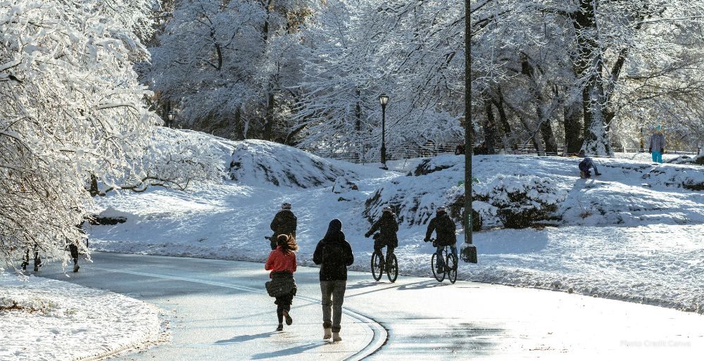
New York City experienced a historic atmospheric event on Sunday as a polar air mass settled over the Northeast, driving temperatures well below those recorded in parts of the Antarctic continent. The intrusion of Arctic air, originating from the northern regions of the Hudson Bay in Canada, brought life-threatening conditions to millions of residents across the tri-state area and New England. Meteorologists noted that the intensity of the cold surpassed previous benchmarks for the region, marking one of the most significant winter weather events in recent decades.
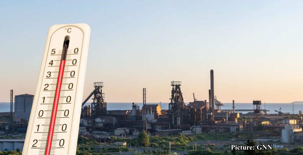
Early Sunday morning, thermometers in Central Park plummeted to 3 degrees Fahrenheit, while relentless winds created wind chill factors as low as 14 degrees below zero. In more exposed areas of the Northeast, the National Weather Service reported wind chills reaching a dangerous 40 degrees below zero. The severity of the conditions prompted the issuance of rare Extreme Cold Warnings for a geographic area encompassing more than 43 million people. These warnings included major metropolitan hubs such as Philadelphia and New York City, where such alerts have not been necessary for nearly twenty years.
The comparative data provided by global weather monitoring stations highlighted the anomaly of the weekend weather. While New York City struggled with single-digit temperatures, McMurdo Station in Antarctica reported a relatively mild temperature of 21 degrees Fahrenheit. This 18-degree disparity underscored the reach of the Arctic blast that successfully migrated south into the mid-Atlantic and Northeast corridors. Forecasters identified the source of this misery as a concentrated pocket of frozen air from the Canadian tundra, which was pushed southward by high-pressure systems.
The human toll of the current winter season has been substantial, with local authorities reporting that at least 17 people have died outdoors in New York City since the start of the year. Medical examiners have confirmed that 13 of those fatalities were the direct result of hypothermia. This tragic data has intensified calls from city officials for residents to remain indoors and for social services to increase outreach to the most vulnerable populations. Emergency shelters remained at high capacity throughout the weekend as the city utilized all available resources to mitigate the impact of the life-threatening freeze.
Meteorological experts at FOX Weather and AccuWeather have characterized this specific cold snap as a generational event. The last time the New York City metropolitan area faced a weather warning of this magnitude was in 2004. According to Dan DePodwin, a senior director of forecasting operations at AccuWeather, this prolonged stretch of cold is the most extreme the Northeast has seen in at least ten years, and in some inland areas, it represents a twenty-year record. Many municipalities are currently on track to record streaks of sub-freezing days that will rank within the top ten longest durations in historical archives.
Despite the severity of the weekend freeze, meteorological models indicate that the region has reached the floor of the temperature drop. A gradual warming trend is forecast to begin early Monday, offering relief to the millions affected by the Arctic front. Monday is projected to see a high of 31 degrees with a low of 19 degrees, which already represents a significant improvement over Sunday’s peak. This shift marks the beginning of a steady climb that forecasters expect will continue throughout the remainder of the week.
By Tuesday, a significant shift in the jet stream is expected to allow warmer air to move into the Northeast. High temperatures are predicted to rise above the freezing mark for the first time in several days, signaling the end of the immediate crisis. AccuWeather meteorologists have suggested that the latter half of the week will feel remarkably mild in comparison to the weekend, with some experts jokingly referring to the upcoming conditions as a localized heat wave. The relief is expected to peak on Wednesday when New York City is forecast to reach a high of 41 degrees.
Jon Porter, the Chief Meteorologist for AccuWeather, noted that the combination of Arctic air and gusty winds made this weekend the most hazardous point of the winter season so far. The rapid transition from extreme cold to more moderate temperatures will likely bring its own set of challenges, including the potential for water main breaks and infrastructure stress as frozen ground begins to thaw. City crews remain on standby to address these logistical concerns as the deep freeze begins to recede.
The historical context of this cold snap serves as a reminder of the volatility of winter weather patterns in the North Atlantic. While residents are accustomed to seasonal snow and freezing temperatures, the arrival of air masses usually reserved for the high Arctic creates unique dangers for urban environments. The successful navigation of this event has required a coordinated effort between the National Weather Service, local emergency management agencies, and the public’s adherence to safety protocols.
As the Arctic air moves out over the Atlantic Ocean, the immediate threat to life and limb is expected to diminish. However, officials continue to urge caution during the transitional period. The focus for many New Yorkers will now shift from survival in the extreme cold to managing the aftermath of the record-breaking weekend. With temperatures set to rise nearly 40 degrees from the weekend’s lowest wind chills, the city is preparing for a return to more typical February conditions.
The resilience of the city’s infrastructure and its inhabitants has been tested by this event. While the numbers from the weekend are stark, the forecast for the coming days provides a necessary respite. The brief but intense period of sub-zero wind chills will likely be remembered as one of the defining weather events of the decade for the New York City region. As the thermometers begin their ascent, the immediate focus remains on ensuring that the warming trend continues as predicted and that no further casualties occur during the final hours of the alert period.
Looking ahead, climatologists will likely analyze the path and duration of this Arctic blast to better understand the increasing frequency of extreme weather fluctuations. For now, the primary concern remains the safe transition into the milder weather predicted for the work week. The contrast between the weekend’s Antarctic-level cold and the upcoming 41-degree high serves as a final testament to the extreme conditions New Yorkers have just endured.